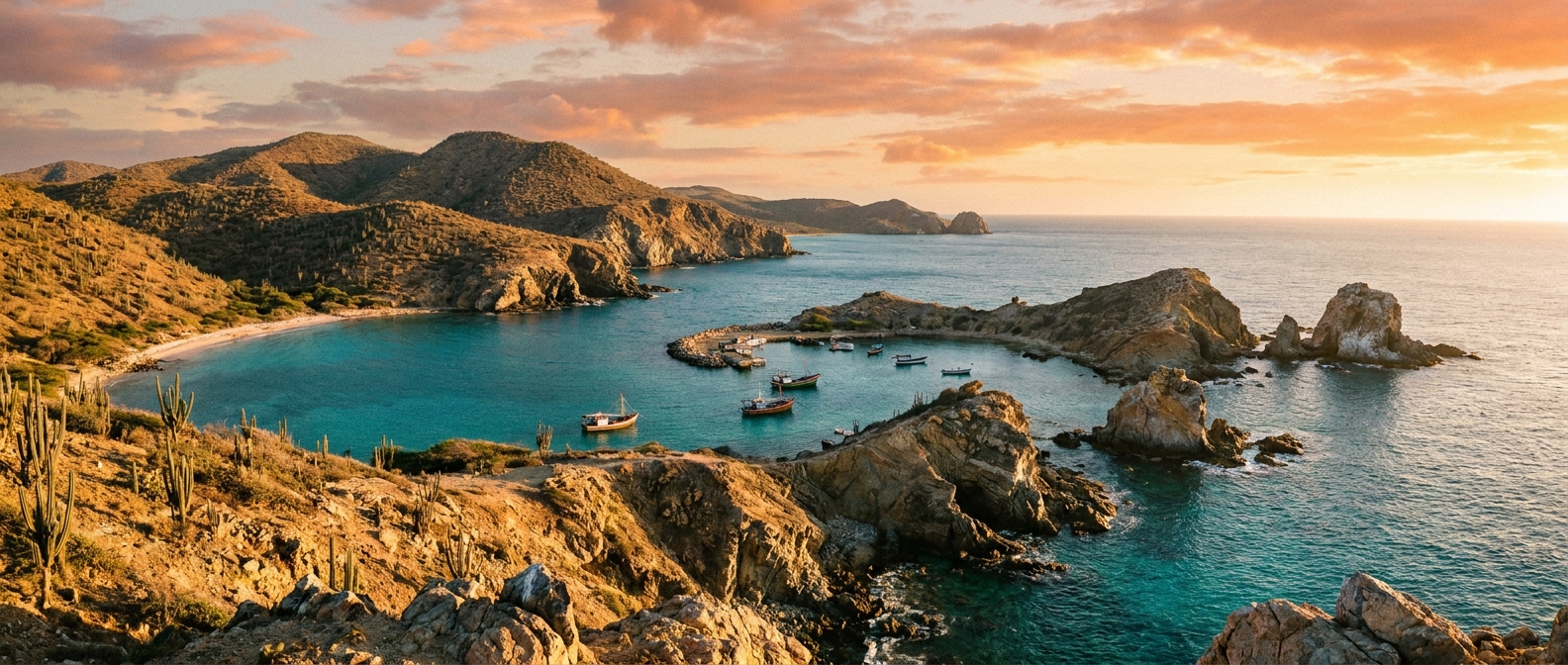
Blanquilla Island has no pier. All cruise passengers arrive by tender, anchoring offshore and ferrying to Playa Yaque.
💡 Pro move: No facilities whatsoever ashore. Wear water shoes — prickly-pear cacti are widespread once you leave the beach.
Blanquilla Island has no dock or pier; all arrivals are by ship's tender to Playa Yaque beach.
| Cruise Line | Typical Berth / Arrival | Dock or Tender |
|---|---|---|
| Most cruise lines (expedition & small-ship) | Playa Yaque, lee (western) shore📍 | Tendered |
| Private yachts & charter | Playa Yaque anchorage📍 | Tendered |
Blanquilla's appeal is entirely natural — extraordinary reefs, deserted beaches, and island wildlife are the programme.
The waters around Blanquilla host some of the Caribbean's last healthy black coral formations. The reef drops sharply — wall diving begins just 65 feet offshore and plunges over 3,000 feet. Visibility is typically excellent.
Find snorkeling gear rental →Powder-white sand and turquoise water with virtually no other visitors beyond your fellow passengers. Playa Yaque is wide and calm — ideal for swimming, sunbathing, and doing absolutely nothing.
Find beach day packages →From Playa Yaque, small boat excursions round the coast to Americano Bay, where dramatic cliffs, a natural rock arch, and further reef sections reward the journey.
Find boat excursions →Follow donkey trails inland to spot iguanas, seabirds, and the resident wild donkey and goat herds that roam the arid scrub. Old ruins of abandoned houses are scattered across the island. Wear closed shoes — cacti are everywhere.
Find guided island walks →Walking on Blanquilla is informal — no paths are marked, but donkey trails connect the beaches and scrubland.
Walk the length of Playa Yaque from the tender landing and back. The beach curves gently; the far ends are usually deserted. Watch for hermit crabs along the tideline.
📍 Open in MapsA donkey-track walk south from Playa Yaque towards the quieter Playa Carantón on the south coast, which has two small beaches and good snorkeling. Wear closed shoes — prickly-pear cacti line the trail throughout. No shade, bring water.
🗺️ See full route in Maps →Climate normals for Blanquilla Island, Federal Dependencies, Venezuela (2014–2023 averages). Pack for the month you sail — highs, lows, and how many rainy days to expect.
| Month | Avg High | Avg Low | Rainy Days |
|---|---|---|---|
| Jan | 80°F / 27°C | 73°F / 23°C | 20 |
| Feb | 80°F / 27°C | 73°F / 23°C | 20 |
| Mar | 80°F / 27°C | 73°F / 23°C | 21 |
| Apr | 81°F / 27°C | 74°F / 23°C | 22 |
| May | 83°F / 28°C | 76°F / 24°C | 26 |
| Jun | 84°F / 29°C | 77°F / 25°C | 24 |
| Jul | 84°F / 29°C | 78°F / 26°C | 27 |
| Aug | 85°F / 29°C | 78°F / 26°C | 27 |
| Sep | 85°F / 29°C | 78°F / 26°C | 25 |
| Oct | 85°F / 29°C | 77°F / 25°C | 25 |
| Nov | 83°F / 28°C | 76°F / 24°C | 25 |
| Dec | 81°F / 27°C | 75°F / 24°C | 22 |
Source: Open-Meteo ERA5 (10-yr daily averages)